Kungsleden 455 km / 283 mi (ENG)
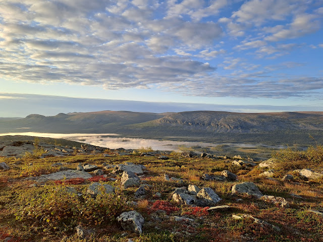
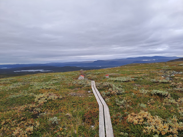
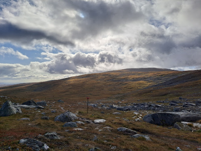
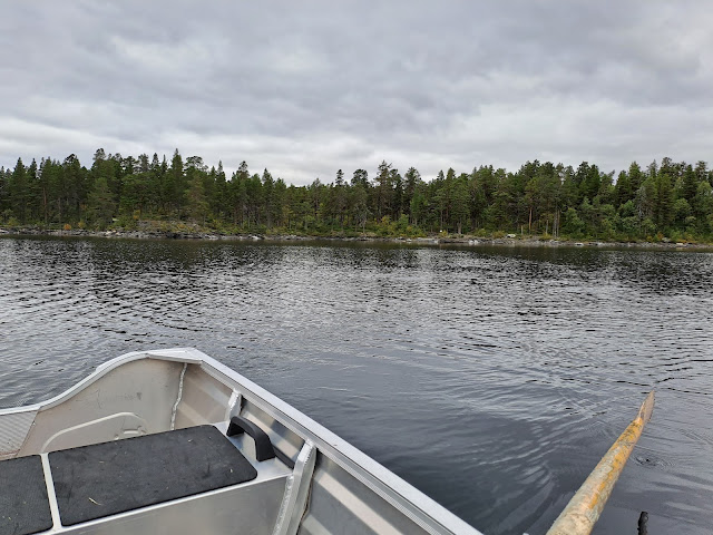
Kungsleden or King’s Trail is a hiking trail in Northern Sweden, Sápmi (Lapland). The journey south begins in Abisko and terminates in Hemavan and spans around 450 km / 280 mi. It offers many beautiful views in the open mountains, boat rides on picturesque lakes, a number of reindeer encounters, some forested bits and a lot of different weather.
A popular alternative starts from Singi hut which takes you to Kebnekaise, the highest mountain in Sweden. As many end their hike further from Kebnekaise, in Nikkaluokta, the shorter stretch from Abisko to there is the most popular. Other than Kebnekaise, you can summit Skierffe and Syter.
Ciccerone Press printed a thorough guide for the trail in 2021.
Eesti keeles: https://muidumatkaja.blogspot.com/2023/10/kungsleden-ee.html
Challenges on trail
I read online that Sápmi has many blood-sucking insects during summer. This influenced my decision to start my hike at the end of summer in the hopes to see less bugs. This is my recommendation to others as well as I only saw five mosquitos and didn’t worry about bugs at all.
The biggest struggles for me were water and boats. Water was in abundance and I never carried more than 0.5L other than for getting to camp. It usually was extremely clear and tasty. I purified my water just once - after Adolfström, where the only sources were lakes which had reindeer poo near them. Other than that there are many small streams constantly providing water. This makes you feel safe until there is a longer stretch without water and you run out. This happened to me between Sitojaure and Aktse where there was no water for five kilometers and I had to push through. Abundant water made it difficult to find campsites and places to dig catholes away from water. Not to mention it made the trail muddy, especially between Kivkkjokk and Jäkkvik.
The other challenge was the schedules of boats and busses. To make them work for you meant either pushing long days or waiting in one spot for an extended period of time (or rowing many kilometers). Luckily I managed to catch all the boats and busses in time which however meant running for it at least once. Only in the second half I can say I hiked in my own tempo for there were less boats to take. I also want to mention the Riebnes boat times, I couldn’t find the schedule online and the guidebook says it departs when there is demand. This however is wrong and you need to call the driver beforehand. In 2023 the boat left at 9 and 16 every day until September. As I was there when September had already started, the boat only left 9 in the morning.
Pace
The length of my hike was 455 km / 283 mi in total which I hiked in less than 12 days. 11 days and 7 hours to be precise. I averaged 38 km or 23.5 mi a day. The constant climbing and descending messed up my schedule as I’ve only hiked in flat Estonia before. Here are daily distances and around where I slept.
Day 1 - 38 km / 23.5 mi - Abisko-Alesjaure
Day 2 - 45 km / 28 mi - Alesjaure-Kebnekaise
Day 3 - 41 km / 25.5 mi - Kebnekaise-Kebnekaise summit attempt-Kaitumjaure
Day 4 - 36 km / 22.5 mi - Kaitumjaure-Sitojaure
Day 5 - 39 km / 24 mi - Sitojaure-Skierffe-Pårte
Day 6 - 41 km / 25.5 mi - Pårte-Kvikkjokk-Tsielejåkk
Day 7 - 40 km / 25 mi - Tsielejåkk-Riebnes
Day 8 - 27 km / 17 mi - Riebnes-Jäkkvik-Pieljekaise
Day 9 - 43 km / 26.5 mi - Pieljekaise-Adolfström-Láddievárdduo mountain
Day 10 - 31 km / 19.5 mi - Láddievárdduo mountain-Ammarnäs
Day 11 - 37 km / 23 mi - Ammarnäs-Tärnasjö
Day 12 - 37 km / 23 mi - Tärnasjö-Hemavan
People
Kungsleden is the most popular trail In Sweden and quite well-known in the world. Compared to Estonian trails, where lucky to meet 3 people in total, here I met over 20 people a day. You meet more people the further north you are as there are more huts there. Apparently Swedish people like sleeping in huts.
On my hike I met many friendly people on the way. Some I talked more to, some I just welcomed. Martin, Kristýna and Lotte were ones who I hiked together for longer. I want to say my thanks to them as they made the hike memorable!
Wildlife
Reindeer! I saw them from the first day until the very end. Most of the time they were afraid of me, however few times they started running away toward me for some reason. It scared me a bit when 15-20 reindeer started coming toward me for obvious reasons.
Didn’t see many other animals, but the willow ptarmigans which were near trail were super cool. I saw five of them on the first day which made a cool start to the hike.
Weather
Fall had reached Sápmi when I arrived. The weather was cool, but the first two days were sunny. It could be said that it was warm, even though the wind was chilly. Going forward the weather was constantly changing with sun, rain and wind. The biggest hurdle was to pass the storm that lasted three nights for me til I reached the valley of Hemavan. Those last days had extreme winds, but luckily just a little rain. Temperatures stayed above freezing most of the time, just on the first night the footbox of my bivy was frozen in the morning.
Money and food
For my trip I had planned 1000€ which I surpassed by 100€. I spent 285€ on equipment, 190€ for transport there, 200€ to come back, 225€ for food and 280€ on other stuff (boats and patches mainly).
I wasn’t great at buying the right amount of food which meant I spent more than necessary - I bought food on an empty stomach. In addition I rewarded myself with too much good food at the end of the hike. I saved money however by bringing the meals for the first six days from Estonia. The bag was heavy in the beginning, but meant I didn’t need to buy food from expensive huts til I got to Kvikkjokk.
Other expenses included boat and a bus rides and STF patches. I spent too much (60€) on them. The boat prices in Aug-Sept 2023:
Teusajaure 150 SEK (STF member)
Langas 175 SEK (STF member)
Sitojaure 380 SEK
Aktse 300 SEK
Kvikkjokk 250 SEK
Riebnes 400 SEK
Only the boat at Teusajaure and the Langas ferry were maintained by STF and members got a discount. In addition these two places + Riebnes were places you could pay with card. Others preferred cash. Most STF huts accepted card. I only ran into problems between Ammarnäs and Hemavan where some said to pay in cash. In total I brought a bit over 2000 SEK (200€) and left with 1000 SEK still with me.
If however you want to spend money, then you have many possibilities for it. Not once did I sleep in or near a hut and so I saved a good sum on it. During the hike I used the facilities just a single time when in Saltoluokta I dried my things. They didn’t ask me for money though. In conclusion the STF membership was kind of useless for me and was more like a donation. If you do want to sleep in the huts, then it does give you a discount however.
Kungsleden passes through towns of Kvikkjokk, Jäkkvik, Adolfström and Ammarnäs. In all, except Adolfström, there is a store to resupply. The largest is the ICA in Jäkkvik where you can find whatever your heart desires. There is a tiny shop part in the Kvikkjokk fjällstation and a small corner shop in Ammarnäs. I recommend stopping at the hostel in Jäkkvik. It only costs 50 SEK to use it during the day, but you get access to the kitchen and power outlets, if you’re lucky you can do laundry and take a shower. Buy soap from ICA beforehand!
Journal
Day 0: I was catching an early morning bus to the plane, but apparently the bus that I had a ticket for didn’t exist. Luckily there was another one going in an hour. I gave away my box with food and sharp things, then went on a plane to Stockholm. I bought food for the trip and hopped on the night train to Abisko. I found my seat and then the long wait started. The seated carriage was bright and noisy which made it hard to fall asleep.
Day 1 - 38 km / 23.5 mi: Abisko-Alesjaure. I usually wake up early and with the time difference I woke up even earlier. I tried to eat all of my food before arrival in Abisko. Once there I became an STF member in the visitor center and then started my hike south! Abisko National Park is a popular spot which meant visitors everywhere. There wasn’t a single cloud in the sky and the weather was hot. Soon I made it to Abiskojaure hut, rested for a second but kept going on. Slowly I made it out of the birch treeline, but I was unaware that I wasn’t going to see trees for many days. I was excited to see what the trail takes me to. I saw a small village further along, but the trail took me to the side of a small lake. When I reached Alesjaure I was disappointed, as the patches were sold out there. Oh well. I hiked a few kilometers more and cowboy camped next to a boulder.
Day 2 - 45 km / 28 mi: Alesjaure-Kebnekaise. Waking up I found out that the footbox of my bivy was covered in frost as the sky was cloudless. I grabbed my stuff quickly to start moving and to get a bit warmer. People were still sleeping when I reached Tjäktjapasset - the highest point on the official trail. I descended into a windy valley where choosing the right clothes was hard - I wound up having to use my wind jacket as a scarf. I passed both Sälka and Singi where they promised good weather for the next morning. This meant that I turned away fro the main trail towards Kebnekaise mountain. It was gorgeous and the trail was great. Though just before looking for a campsite I had to trudge through knee-deep mud.
Day 3 - 41 km / 25.5 mi: Kebnekaise-Kebnekaise summit attempt-Kaitumjaure. Despite the promise of good weather, the sky was gray. After a short stop at Kebnekaise visitor center I started my ascent towards the summit. Soon however it started raining a bit and the clouds were quite low. I had the goal in mind however and kept going up. The visibility kept getting lower with every step. At one point me and four other random hikers made a group to keep going up. The wind was getting stronger and facing a steep climb I decided to quit and hike back. I later learned that the others hadn’t managed that far either and stopped after that climb. It was time to turn back toward Singi and the main trail. This was the part where many don’t continue on for the rest of the trail. I made it to Kaitumjaure in the dark, bought a patch and kept going for few kilometers more. It was pouring rain when I plopped my things down next to the trail near a river. Finally some rest.
Day 4 - 36 km / 22.5 mi: Kaitumjaure-Sitojaure. An early start was no fun as the sky was gray and soon I was walking in a cloud. I had to get to Teusajaure however to cross with a boat. I had understood that the boat left at 7 so I ran down the mountainside to catch it. To my surprise the boat was supposed to leave 30 min later. On the other side I climbed a plateau where I met Martin and Kristýna with who I hiked to Vakkotavare hut. There we and other hikers were drying and waited for a bus. This section includes a roadwalk that also has a bus which takes you from Vakkotavare to the ferry. We stopped to eat a slice of pizza and then we were on the boat to Saltoluokta. I quickly used the drying rooms, said goodbye to Martin and kept hiking. The weather had turned nice and it was a great time to hike. I passed Kristýna in the evening. I made my camp few kilometeres before Sitojaure.
Day 5 - 39 km / 24 mi: Sitojaure-Skierffe-Pårte. Kristýna caught up to me in the morning and we hopped on the Sitojaure boat together. Under the hot sun hiking toward Aktse I ran out of water. Luckily I didn’t have to hike thirsty for a long time. I set my things to dry near Aktse hut and then started to summit Skierffe. I think the climb out of Aktse was the hardest part of it, after turning away from the Kungsleden the trail was no longer steep. If I’d do it again I would leave my pack somewhere near the trail junction, pick up some water further toward Aktse and then climb Skierffe with no pack. The view was amazing there and I really recommend going there. I hurried back to catch the boat, but the hut warden was mad at me for leaving my items there for some reason. I took my stuff and ran for over a kilometer to the boat and luckily caught it. I wouldn’t have wanted to row 10 km. After crossing the lake I had an adrenaline crash however. Everything seemed pointless going forward, but I tried to manage my feelings and kept hiking til the evening.
Day 6 - 41 km / 25.5 mi: Pårte-Kvikkjokk-Tsielejåkk. Apparently I had slept few hundred meters from Kristýna and also Lotte who I had met yesterday. They caught up to me at Pårte and we kept hiking together to catch the boat at Kvikkjokk. Lotte got left behing as we were afraid we wouldn’t catch the boat. However we were quick and made it so we had time to shop in Kvikkjokk. We crossed the river delta, got a small tour on the boat and made it to the next section. I said goodbye to both of them and continued solo. The nature around me reminded me of Estonia, but on a mountainside. My mood was low again as I continued alone and there wasn’t much to look forward. Thankfully the bright yellow birch forest around me looked gorgeous.
Day 7 - 40 km / 25 mi: Tsielejåkk-Riebnes. It was gray all around me in the morning when I descended into the forest. I met three cool hikers, but it was a short meeting. The muddiest place on all Kunglseden started immediately after the rapids. The section between Kvikkjokk and Jäkkvik is supposedly the least popular because the nature is boring. I disagree, I think it’s because the trail is unmaintained. Constant knee-deep mud doesn’t excite everyone. Back up high I contacted the Riebnes boat driver and confirmed that the boat leaves at 9 in the morning. Soon the rain returned but I kept going strong, gray birches around me. Fall had definitely arrived. Few kilometers from Riebnes I stopped and set up camp.
Day 8 - 27 km / 17 mi: Riebnes-Jäkkvik-Pieljekaise. I made it to Riebnes quite early which left me time to dry my things while I waited for the boat. After paying a large sum to cross I chatted with some other hikers who I also were going to meet in Jäkkvik. The trail climbed out of the forest for a second, but then descended again. The hiking took a long time and I was glad to finally reach the rowing boats. This is the only spot you must row at. Continuing on the first road-walk on Kungsleden, you make it to Jäkkvik. I was quite lost in the large store and another hiker brought me to the hostel there. I charged my stuff, repackaged my food and took a quick shower. The other stayed there and even though I thought about doing the same and hiking with them, I wasn’t willing to pay so much just to sleep under my tarp (the beds were full). I managed to set up my tarp before the rain in the evening. I was in the mountains however.
Day 9 - 43 km / 26.5 mi: Pieljekaise-Adolfström-Láddievárdduo mountain. In the morning I descended into the forest and didn’t leave it for a long time. However the nature was still gorgeous and I wasn’t disappointed for once. The only place on this trail where I got lost happened just before Adolfström. I guess the trail used to pass the town? Anyway I followed the old markings, but they were wrong. The new markings started had kept going on the road and I didn’t see them. I walked through Adolfström and now instead of single-track, the hiking took place on ATV tracks.
Clouds further up predicted a storm. Now looking back I made a stupid mistake by setting up in a poor spot. I woke up an hour later and the storm was raging out. Another hour passed with me just not knowing what to do when I finally packed my stuff and moved. I feared my tarp was going to break if I didn’t. I was quite afraid of Mother Nature at this time. I set up my tarp as low as possible next to the mountain and crawled in. I was safe from the wind and rain, but the wet ground was cold and didn’t sleep much.
Day 10 - 31 km / 19.5 mi: Láddievárdduo mountain-Ammarnäs. In the early hours of the morning I packed my stuff and pushed forward in the strong winds. I almost flew away. I made a decision to take the old Kungsleden trail. It isn’t maintained anymore, but it’s shorter and lower in altitude. Dark clouds were moving towards the new route and I wanted to get to Ammarnäs as soon as possible. The old forested trail was pretty as well and the markings were still visible. When I made it to Ammarnäs I bought food for the last section, hiked a bit out of the town and set up my camp in the afternoon. I ate, rested and enjoyed the calm.
Day 11 - 37 km / 23 mi: Ammarnäs-Tärnasjö. The storm kept going the whole night, but I was relaxed low in the forest. I saw the tops of the trees swinging wildly. Weather was still odd in the morning and wind kept blowing. In the first hut I passed the warden told me there had been extreme winds up there. Further along the trail rain joined the wind and I made a stop in the emergency hut. I met two nice hikers there as well. From this moment the weather was a bit nicer, but the wardens at Serve told me the storm was going to continue. This meant I tried my best to reach Tarnasjö by the evening as there was the only next place with trees around you. I made it when the sun had already set and set up my camp quite near the hut.
Day 12 - 37 km / 23 mi: Tärnasjö-Hemavan. The night had gone nice and I had a pep in my step. This was going to be the lasst day! The Syter hut was empty and I only passed a few hikers on this last stretch. I could’ve summited Syter, but it had just snowed and as I was alone with no previous experience, I decided to skip it. I made it to the last vast valley where strong wind tried to keep me humble. In the emergency hut I chatted with few more hikers, but then I continued towards the last hut. It was quite surreal to know that I only had 10 kilometers to the terminus. I climbed the last ascent and could already see Hemavan. Descended under sky lifts and through a road construction but then there it was. A sign welcoming to Hemavan. A wonderful hike in Sápmi was over, I overcame many hurdles and got a many cool experiences!
Leaving. There was no one in the visitor center at Hemavan, but when I called them I learned that camping in their yard costs 10€. I decided to walk back to the trail and to camp somewhere near there for free. Even though some dogs started barking at me, the night was peaceful. In the morning I spent time in the visitor center waiting for the bus to Umeå. I sent my sharp things back with post and bought food for the way home. I was a bit smarter this time and had a bed spot on the night train back to Stockholm. There I hopped on few flights and was back in Estonia.
Gear
In the end I was quite happy with my gear. My baseweight was 3.4 kg or 7.6 lbs. The full list is visible here: https://lighterpack.com/r/tret6z
I was happiest with my Yama Cirriform tarp which held me dry and safe in a storm. It saved me from my own stupidity. I also was super happy with my Injinji Run 2.0 toe socks as it was my first long-distance hike with no blisters.
My Nashville Cutaway backpack, Katabatic Gear Alsek quilt and a small piece of Decathlon CCF pad were great to use and can’t wish for more.
I’ve been happy with my clothing on previous hikes and this one was no different. The only thing I’ll change is my MYOG rain skirt is too light and blows away in the wind. A new thing I was testing is the Timmermade Climashield Jacket which kept me warm in the cold winds. A thing I disliked however was the hood, which has a bad cut so it falls on my eyes constantly. Other than that it was quite nice to own.
On this hike I also tested a turkey oven bag as a sleeping pad cover when using it as a frame and carrying outside of the pack. After this test I’m pretty sure I’ll continue to use it like this. The pad stayed mostly dry even in strong rain.
What would I have changed or left behind? Hiking this late in the season you don’t need bug protection. Instead of a bivy I could’ve just used Polycro and the other bug items could have been left behind. I also didn’t need as much soap, as you can wash your hands with soap next to the huts. And also as there wasn’t much sun I could’ve left my sunglasses at home. Lastly I didn’t use the torso cutout from a rain poncho which was there to keep me warm just in case.
Favorite sections
On the second day it really dawned on me that I truly am hiking here in Northern Sweden and on that day I also passed through the gorgeous Singi-Kebnekaise valley. The views were amazing after Saltoluokta as well. I do have to mention the summit of Skierffe and the golden birch valley past Kvikkjokk in addition. But at the same time almost all places were beautiful and relaxing. Mud and wet feet are soon forgotten and only the good stays in memories.


